The Balsham Map Project
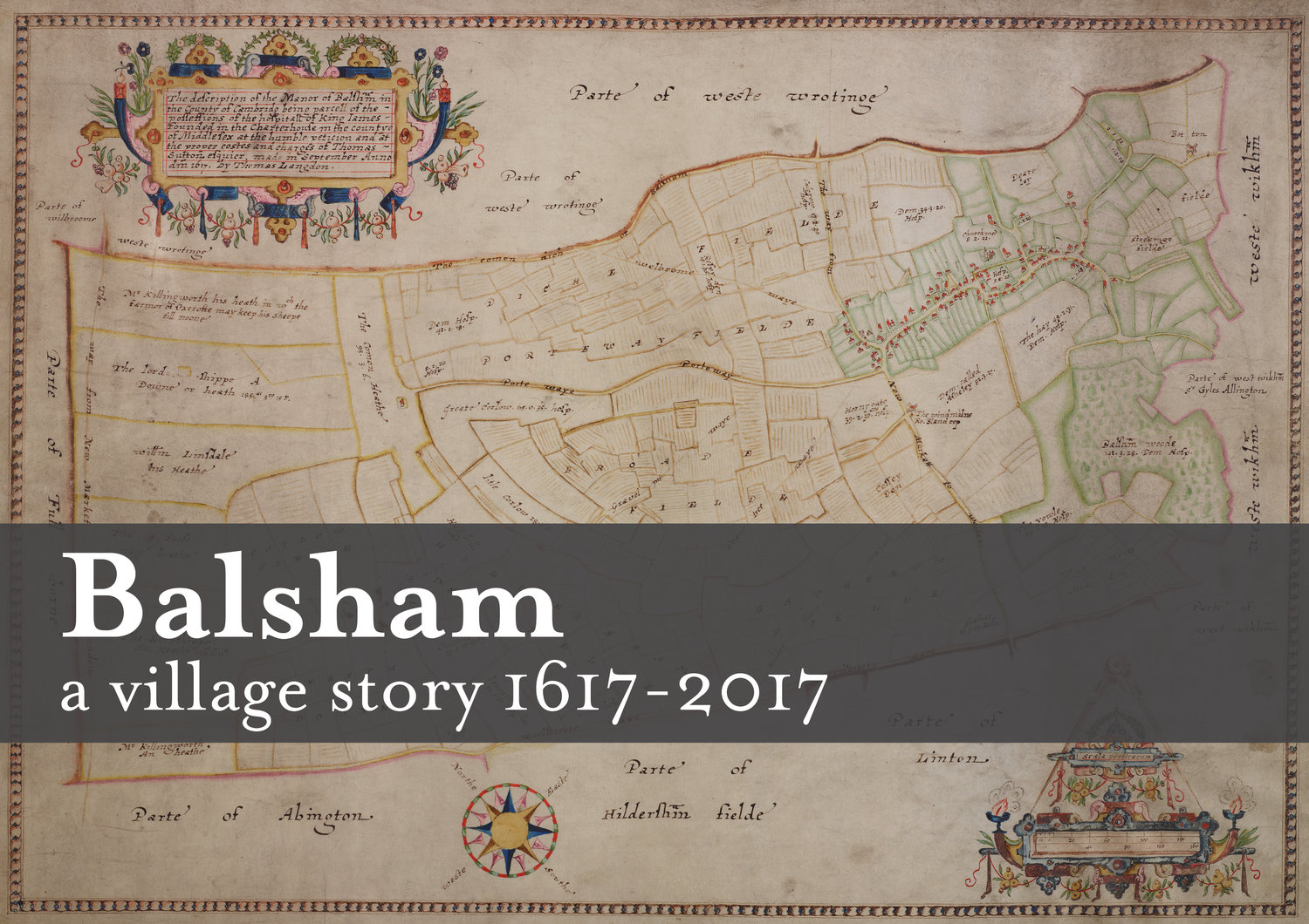
The Balsham Map Project was inspired by a talk by Sue Oosthuizen, University Senior Lecturer in Historic Environment from the University of Cambridge. The presentation featured the oldest known map of Balsham, dated 1617, created by Thomas Langdon for London Charterhouse.
This precious document was too interesting to be ignored and so began the plan to produce a book to celebrate it’s 400th anniversary.
We have lots of enthusiastic help and professional experience. We have the expertise of people working in the publishing and printing industry, a cartographer, who has been invaluable, people with local information, including local archivist holding numerous records and photographs which have been catalogued by previous generations.
Our team have IT skills as well knowledge of our local landscape and the church records.
We welcome new faces to help us on our journey. You can find out more on this site.
A book for every resident
We would like to publish a printed, full colour A4 book for each resident living in the village in 2017. Our research and archive material will be donated to the village archives as a legacy for future generations.
We will be using as many maps that are available, plus other archive material already held in the village. Various booklets about Balsham have been written previously, but now is the chance to collate this into one volume. Visits to the London Metropolitan Archives and Local Archives have been an excellent source of help and information. The Cambridge University Library hold further material and have expressed their willingness to help with our research; a visit there is planned very soon.
At present we aim to spend 2014 to end of 2015 researching the village in 1617 with a view to writing our content ready for editing, design and production in 2016.
Alongside this we are actively fundraising and you can find out more about this on our blog.

Thomas Langdon's 1617 map of Balsham